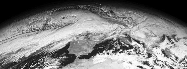
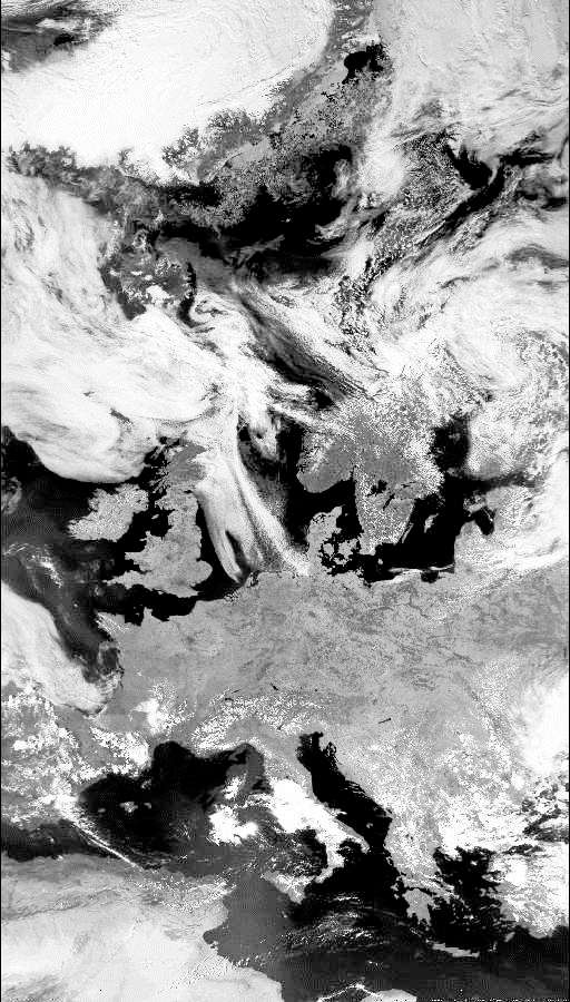
Meteosat visible light band image: 26th December 1998
Weather satellite images

Image Archive - some interesting images!
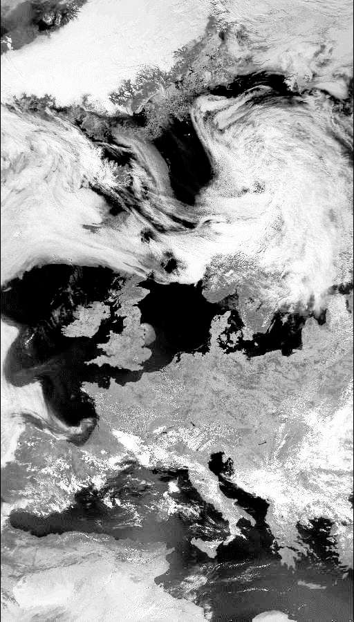
Storms over England
-
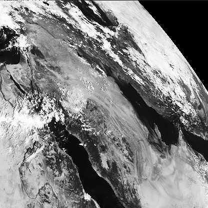
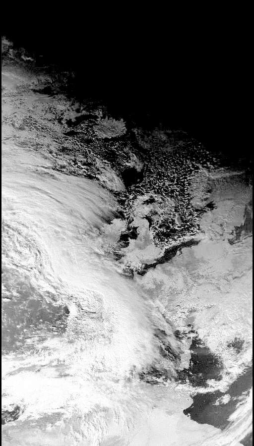
The 'Great Storm of 1987' - a sequence of Meteosat whole earth images. Download and animate the sequence to watch the storm developing and passing
across Europe.
October 13th October 14th October 15th October 16th October 17th
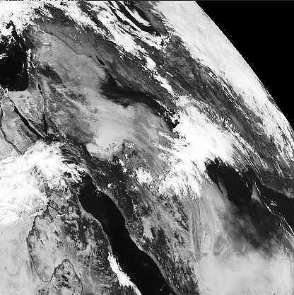
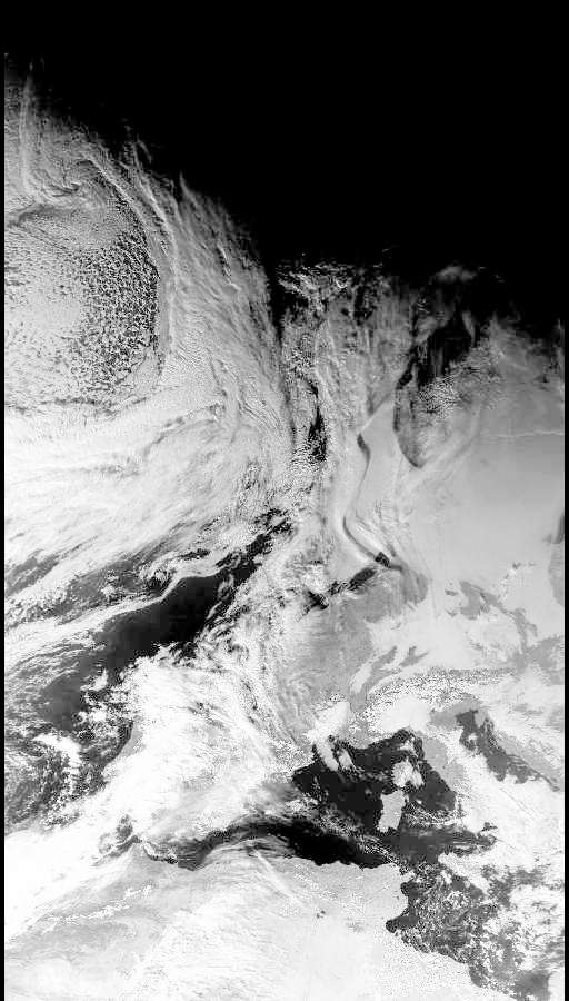
The storm of January 1990 - sequence of Meteosat images of the second storm to bring devastation to southern England.
January 22nd January 23rd January 24th January 25th January 26th January 27th
The Gulf War oilfield fires
-
The aftermath of the Gulf War, 1991. As Iraqi troops were pushed back out of Kuwait, Saddam Hussein ordered the burning of the Kuwaiti oil wells - providing one of the greatest environmental disasters ever. These images show the burning oil fields in Kuwait leaving a pall of smoke spreading across Saudi Arabia and the Gulf States in February 1991.
22nd February 23rd February 24th February
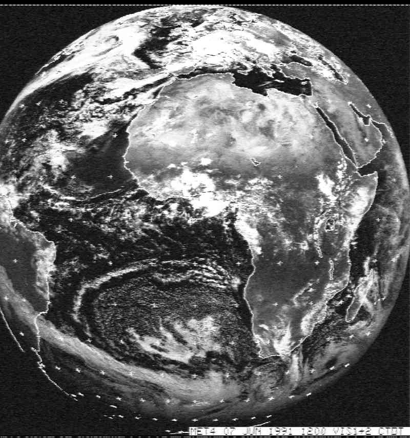
In June, the oil fields were still burning. This whole Earth visible light image shows the smoke plume over Saudi Arabia - the size of the smoke is clearly visible on even a whole world view!
June 7th 1991
The last oil well fires were not extinguished until November 1991, ten months after the fires were started.
Anti-Cyclonic conditions in Summer and Winter
-
Summer sun over the UK! Low level image from NOAA 14 in 1995 shows summer anticyclonic conditions over the UK providing clear skies and scorching temperatures. These fine summer images in bright sunshine show considerable detail - you should be able to see the Isle of Wight, Alpine lakes and the large urban sprawls of London, Birmingham and Paris.
June 28th 1995 June 29th 1995
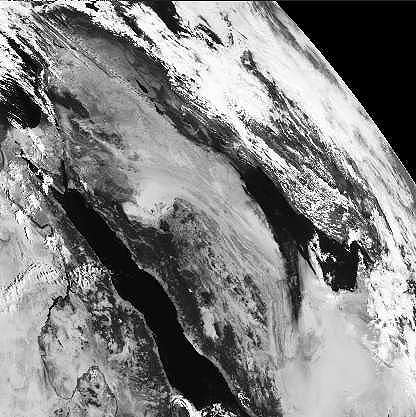
Winter anticyclones also provide clear skies - but the lack of cloud cover means that temperatures are low. A few days before this image was taken, the Shetland Islands and Northern Scotland experienced some of the heaviest snow falls for 40 years. Anticyclonic conditions over the North Sea blocked the warmer conditions and frontal systems to the South West from moving across the UK to bring warmer air from the south to replace the cold Arctic air from the north. Night time temperatures fell as low as -24 C. Note how close the limit of mid-winter daylight is to the north of the UK!
December 27th 1995 - near Arctic conditions over the UK at Christmas 1995
Winter fog over Europe
- Foggy conditions over Eastern England (Newcastle to Kent) and Europe on 15th January 1996 reduced visibility to less than 50m. These conditions were brought about by a weakening cold front lying north to south over eastern England. This moved slowly eastwards whilst an anticyclone over Eastern Europe pushed westwards creating a ridge of high pressure that extended in the eastern UK.
15th January 1996
Winter snowfalls across the UK
- An occluded front lying north/south over the UK brought some of the worst snowfalls in 50 years to the Borders regions with up to 50cm of snow falling across Dumfries and Galloway on February 6th 1996. Warm moist air from the Atlantic was forced to rise above cold continental air. Snow was formed at the junction between the warm and cold air masses, falling along the line of the front. The front extended to the south coast, bringing many cm of snow across Devon, Dorset and Hampshire. The occluded front was followed by a depression moving in from the Atlantic, bringing further frontal conditions and further snowfalls. The clear skies behind the occluded front brought low temperatures overnight with the slushy snow turning to ice.
6th February 1996
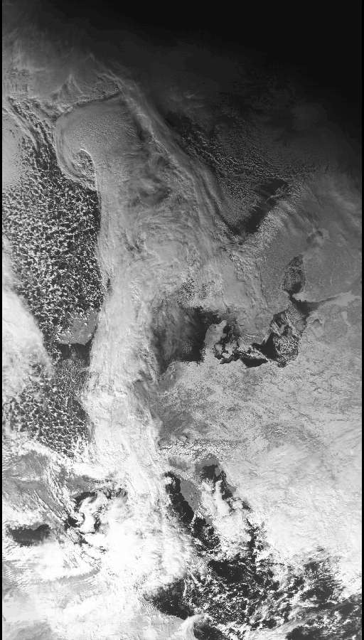
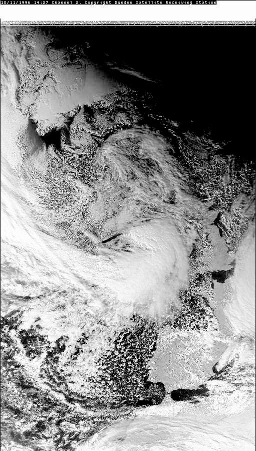
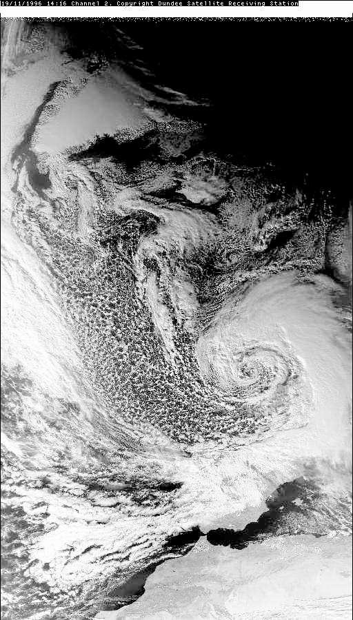
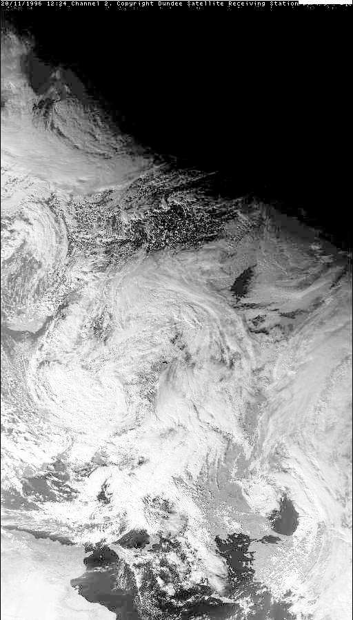
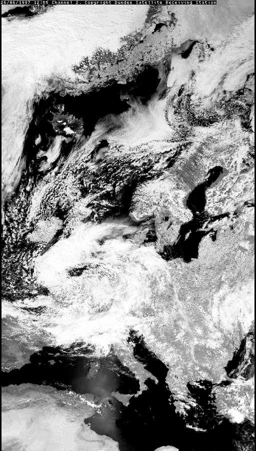
November snow across Britain
- An unusually deep depression - at 960mB one of the lowest depressions for 50 years - brought unusually severe weather to the UK in November 1996.
Very heavy rain across southern England turned to heavy snowfalls across Wales and the Midlands - bringing widespread disruption, power failures and more.
Severe gales along the south coast made sea conditions dangerous - a large freighter dragged her anchor and was blown on to a sandbank off Portsmouth.
The images from the NOAA low level orbiter show the passage of this severe depression across the UK as it arrives (18th), deepens bringing rain and snow (19th) and moves away (20th).
- 18th November 1996 - the approaching storm
- 19th November 1996 - deep depression centred over the UK
- 20th November 1996 - moving across Europe
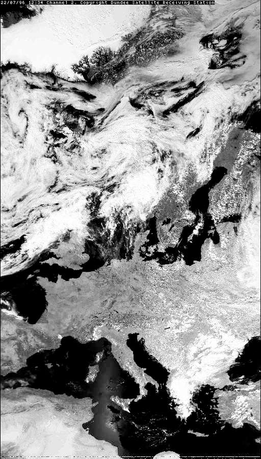
Clear skies over Western Europe
-
Europe enjoyed summer sun in July 1996 - with much detail being visible in satellite images. This image - 22nd July
1996 shows major rivers and lakes, the Isle of Wight, Channel Islands and major population centres - London, Birmingham, Paris etc.
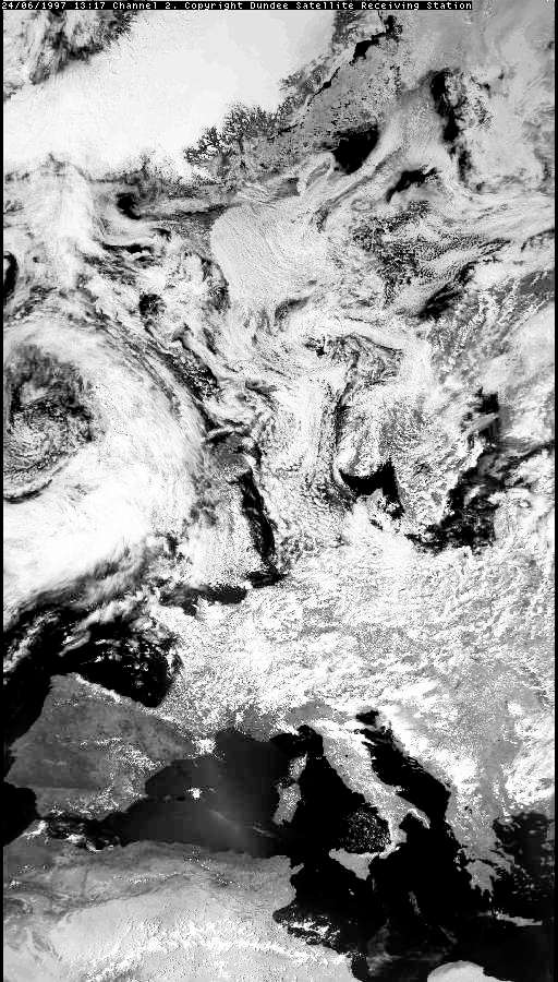
Unseasonal summer weather 1 - June 1997
- A deep depression remained almost stationary, situated over south eastern England and the Channel. Winds swirled around the depression in an
anticlockwise direction, bringing north easterly winds over the North Sea and then across the UK. The air blowing over the North Sea picked up
large quantities of moisture which fell as rain across central and southern England, producing the wettest June this century.
- 24th June 1997 - the frontal system approaches the UK
- 26th June 1997 - a depression centred over the English Channel
Compare these images with the same period in 1995 - 28th June - more seasonal weather in the 'flaming June' style!.
For the first time since 1909, the Wimbledon tennis championships were rained off for two consecutive days; the Glastonbury 'festival' field was churned into a sea of mud; the Test Match was shortened due to heavy rain (result: a draw between England and Australia); a shop in Bristol reported sales of a year's supply of wellington boots in 2 days; the Environment Agency place 4 Devon rivers on flood alert as it reported that more rain had fallen in 24 hours (26th June) than was normal for the whole of the month; Yorkshire Water reported reservoir levels at 90% and well above normal for the time of year.
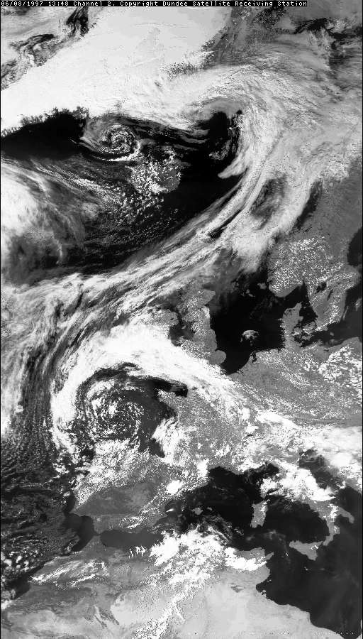
Unseasonal summer weather 2 - August 1997
- A depression over the Bay of Biscay created a strong frontal system over the southern part of Britain and Ireland. Severe rainstorms brought
widespread flooding - some areas reported rainfall as heavy as 25mm (1 inch) per hour with normal monthly totals for the time of year exceeded in a
matter of only a few hours. Nine rivers were placed on flood alert by the National Rivers Authority - parts of Somerset were under several feet of
water as rivers burst their banks. Many holidaymakers decided to cut short their holidays in the South-West and headed back home to the Midlands
and the North - returning to sunshine!
- 6th August 1997 - frontal clouds cover southern UK and Ireland bringing severe rain storms and thunder whilst the
North of the country basks in the traditional summer sunshine
- Europe section - 6th August 1997
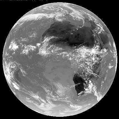
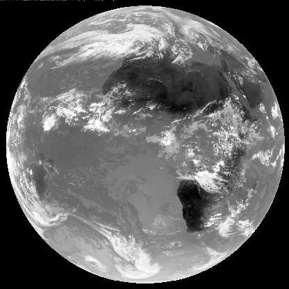
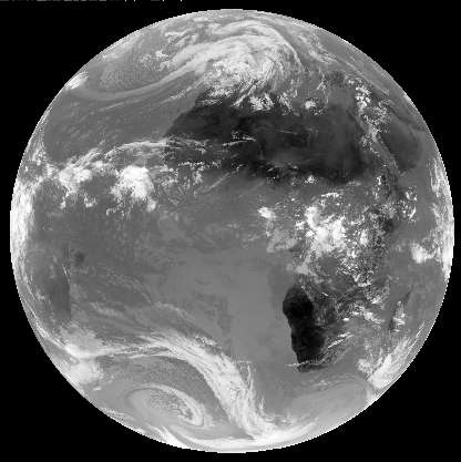
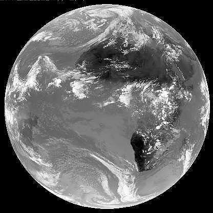
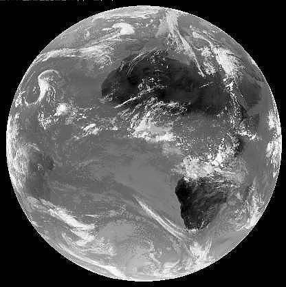
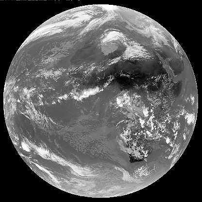
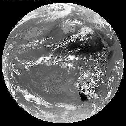
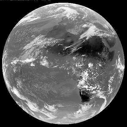
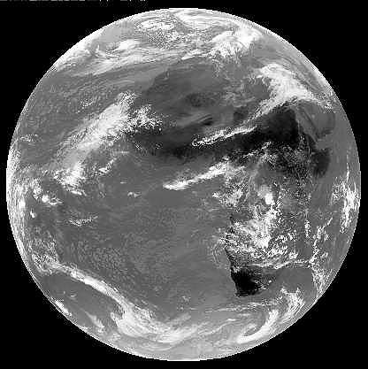
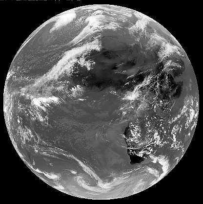
The Winter Solstice
-
The winter solstice is the time when the Sun reaches its most southerly position - overhead along the
Tropic of Capricorn. On this day, the Northern Hemisphere experiences its shortest day - and the official
beginning of winter. In the south, it is the start of summer - and days are long.
Check the satellite images to see the seasonal effects. After the winter solstice days get longer and the Sun rises higher in the sky - summer is coming!
Destruction from the air - Hurricanes
Hurricane Andrew - one of the most destructive hurricanes- Hurricane Andrew approaches the Florida coast - August 23rd 1992
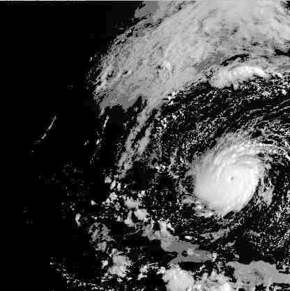
Later the same day - closer to the shore and a deepening eye as the hurricane grows in strength
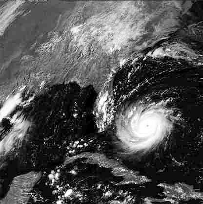
Having swept across southern Florida, Hurricane Andrew moves out across the Gulf of Mexico - 24th August 1992
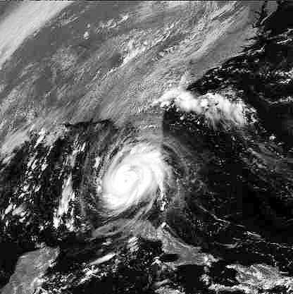
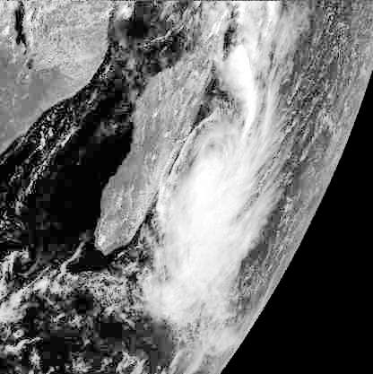
Hurricane Kelvina - a southern hurricane off the coast of Madagascar
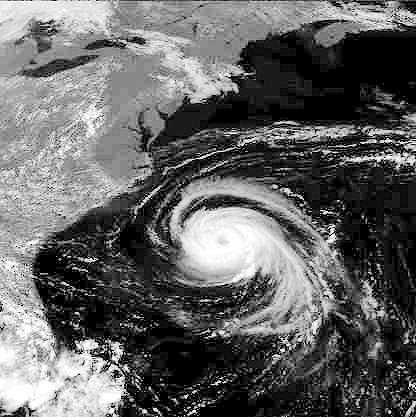
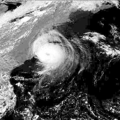
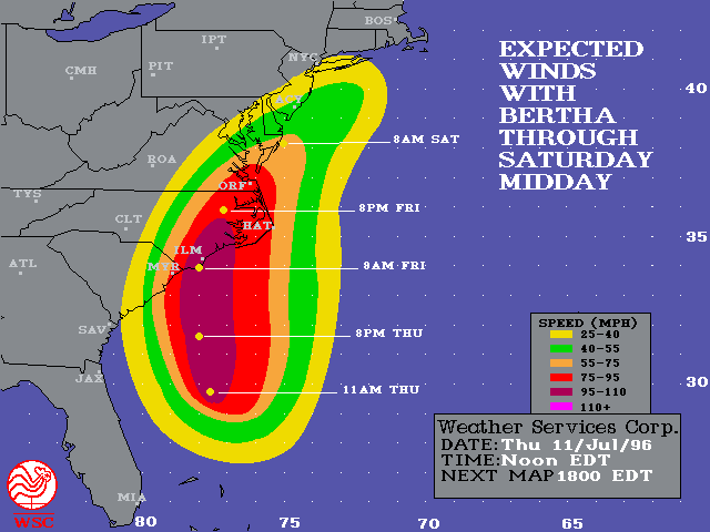
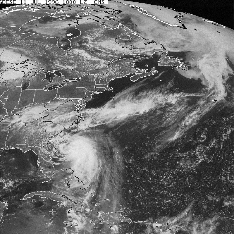
Hurricane Bertha - an early hurricane (July) in summer 1996. Predicted winds caused cancellation of travel services, the US Navy sent ships to sea and the NASA Shuttle was rolled back under cover.
In the northern hemisphere, the hurricane 'season' is from mid to late August to the end of November. In the southern hemisphere it will be from mid February to the end of May. The most likely times to spot hurricanes are September and March respectively.
Acknowledgements:
Images: ESA, St. Vincent College, NERC Satellite Project, Dundee University

![]() Back to main Weather
index page
Back to main Weather
index page
Page update: January 12th 1999
This version: © St. Vincent College