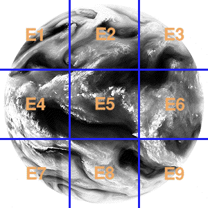
Meteosat image segments: WEFAX format images
Meteosat acquires images in 3 bands - Visible light, Thermal Infra Red and 6 micron Water Absorption band (imaged in
the infra red band). Original High Resolution images are processed and retransmitted according to a 4 minute schedule in WEFAX (Weather Fax)
format.
The image maps are not current segments and are to represent the geographical coverage only - click on a segment or the full Earth disk to download the current image - or go to a text only version.
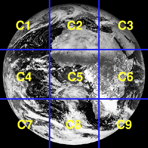
Visible light band images - Europe, Atlantic, Africa
Images in JPEG format (100k approx), Lat/Long grid and coastline added. Please select an image segment to download
|
|
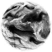
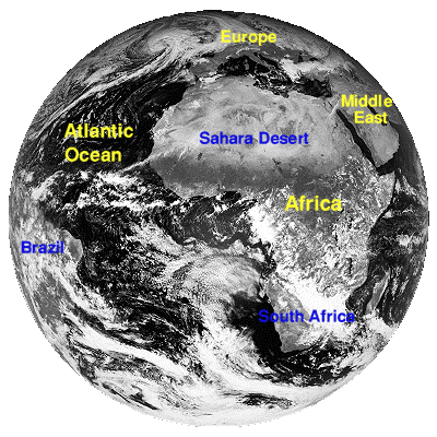
Meteosat full Earth disk in visible light: Image format - CTOT
|
|
Two 'zoom' close up WEFAX format images are available to show more detail of weather patterns over Europe. C02 shows Western Europe (west of
the Greenwich Meridian), C02 shows Central and Eastern Europe (to the East of the Greenwich Meridian).


For detail, use the Meteosat high resolution visble image taken at 12:00 UTC.
|
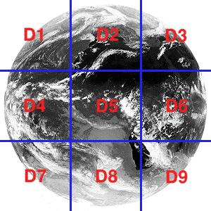
Thermal Infra-Red band images - Europe, Atlantic, Africa
Images in JPEG format (100k approx), Lat/Long grid and coastline added. Please select an image segment to download
|
|
Meteosat full Earth disk in thermal band infra red: Image format - DTOT
|
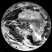
6µm IR Water Absorption band - Europe, Atlantic, Africa
Images in JPEG format (100k approx), Lat/Long grid and coastline added. Images cover the same geographical areas as for Visible and
Thermal bands but show water vapour in the upper atmosphere. Coastlines etc. are added for identification purposes only. These images
do not always give a good indication of ground level conditions.
|
|
Meteosat full Earth disk in 6µm water absorption band (infra red): Image format - ETOT
|


![[ PDUS Meteosat ]](images/pdusMET.jpg)
![[ CTH ]](http://www.ccc.nottingham.ac.uk/pub/sat-images/CTH.JPG)
![[ Admin ]](http://www.ccc.nottingham.ac.uk/pub/sat-images/ADMIN.JPG)