Meteosat

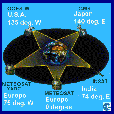
Meteosat is one of a network of five satellites placed in geostationary orbit to observe the Earth's weather. These satellites form the Global Atmospheric Research Program (GARP) suggested by the United Nations to improve world wide weather forecasting. The five satellites are spaced out around the equatorial 'Clarke belt' at an orbital altitude of 36,000 km. At this altitude their orbital period matches the rotation of the earth so that they each continue to observe the same view of the Earth below them. The GARP program satellites include:
-
Meteosat operated by EUMETSAT at 0°
GOES E (Geostationary Operational Environmental Satellite) operated by the USA at 75°W
GOES W operated by the USA at 135°W
GMS (Geostationary Meteorological Satellite) operated by Japan at 140°E
Insat operated by India at 74°E
 Click to download larger image
Meteosat 1 was launched in November 1977. From its orbital location of 0° it was able to transmit images of Europe, the Atlantic, the whole of Africa, the Middle East and part of South America. The first three satellites formed an experimental programme with Meteosat 2 going into orbit in June 1981 and Meteosat-3 (build from spare parts left over from 1 and 2) launched in June 1988.
When the US GOES-W satellite failed in 1989, it was replaced by moving the GOES-E satellite to the 135°W position. With Meteosat-4 then in orbit and operational, Meteosat-3 was loaned to the US and moved to 75°W to provide coverage of the USA. This was operated as the Meteosat XADC (extended Atlantic data coverage) downlinking data to the US NOAA agency for US weather forecasting. Meteosat-3 reached the end of its life in November 1995 when its final remaining fuel was used to boost it 500km above the geostationary orbit where its systems were switched off. From an initial design life of 5 years, Meteosat-3 had remained in operational use for seven years.
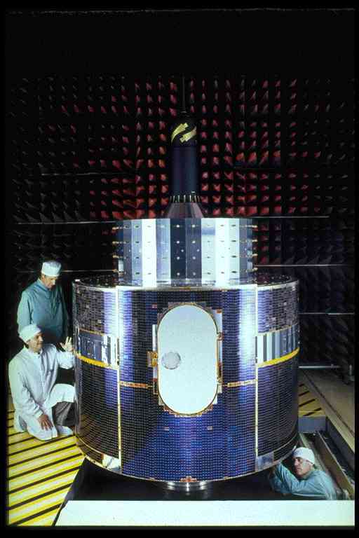 Meteosat 6 under final testing at the Aerospatiale construction facility, Cannes
A new intergovernmental organisation, EUMETSAT, was set up to manage the finance the Meteosat programme from 1985 onwards. The first of the operational satellites was Meteosat-4 launched in March 1989. The current operational satellite is Meteosat-6 launched in November 1993. EUMETSAT owns and finances the operational spacecraft which are constructed and launched by the European Space Agency (ESA).
Meteosat has two major components to its systems - the actual operational spacecraft in orbit and the ground segment. The operational satellites are located at 0° orbital position. One satellite (the primary spacecraft - currently Meteosat-7) is active whilst the reserve satellite is kept nearby in a standby mode. The satellites can be manoeuvred to any location above the Equator.
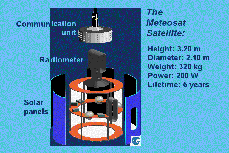
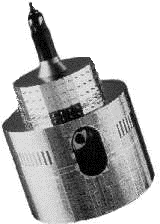
All Meteosat satellites are constucted from a cylindrical body of length 3.195m and diameter 2.1 metres. The satellites have an orbital mass of 320 kg which includes 39 kg of consumable hydrazine propellant used for orbital manoeuvers. The satellite is set to spin at 100 rpm around its main axis which is aligned parallel to the Earth's north south axis. The principal payload is the multi-spectral scanning radiometer which provides images of the Earth in each of the three wavebands (visible, water vapour absorption infra red and thermal infra red). Additional instruments and equipment provides facilities to relay automatic weather data from land based stations, ships and aircraft.
A set of three earth images is collected every 30 minutes. The digital image data is transmitted to the EUMETSAT Operations Centre at Darmstadt, Germany, where the image data is processed. The raw whole earth disk images are boken down into the secondary segments and coastlines and latitude/longitude grids are added. The final processed images are then uploaded back to the satellite where power amplifiers transmit them to end users as analogue WEFAX signals.
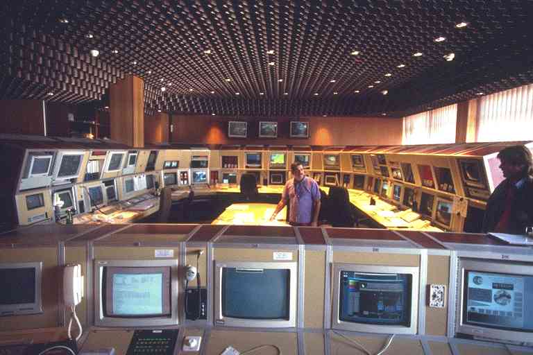 The EUMETSAT Meteosat control centre in Germany
NEW Meteosat programme announced
EUMETSAT has now announced that a new second generation of Meteosat platforms are under way. A new network of satellites costing some £2.5 Billion is planned with the first launch programmed for October 2000. The new satellites will provide more detailed and accurate weather forecasting across Britain and Europe.
The satellite (MSG-1) will be the first of three second generation platforms in a 14 year mission intended to provide weather data for the 17 national weather services in Eumetsat. The second generation satellites are expected to generate images every 15 minutes instead of the current mission sequence of every 30 minutes and will have a much improved resolution, being capable of imaging areas of 1Km instead of the current 2.5Km. The new satellites will carry much more data traffic (around a 100 times greater than at present) enabling the rapid transfer of data to forecast local events such as thunderstorms and small scale but devastating depressions.
More Meteosat information
Meteosat - general information
Operating from a geostationary orbit above the intersection of the Equator and the Greenwich Meridian (0°), Meteosat observes the Earth in three spectral bands every 30 minutes.
Meteosat - general information
Height 3.20 mPayload instrumentation
Diameter 2.10 m
Mass 320 kg
Launch mass 696 kgElectrical power 200 W
Stabilisation Spin - 100rpm
Orbit 36,000 km - geostationary 0° longitude
Prime contractor Aerospatiale
Operator ESA
Design lifetime 5 yearsLaunch vehicle ESA Arianne
Launch site ESA Kourou - French Guyana
Multi-spectral radiometerMission
Wavebands 0.4 - 1.1 µm (visible)
5.7 - 7.1 µm (IR, water vapour absorption)
10.5 - 12.5 µm (thermal IR)
Resolution 2.5 km in the visible band
5.0 km in IR bands
Image repeat frequency 30 minutes (3 bands)Meteorological Data Dissemination (MDD)
Channels 1 1694.5 MHz (digital high resolution HRI)
2 1691.0 MHz (analogue Weather facsimile - WEFAX)
Observation of cloud cover, windspeeds, sea and cloud surface temperatures,
water vapour distribution in the upper troposhere.
Image acquisition, distribution of image data and other weather information,
collection and relay of weather data from data collection platforms (DCPs),
land, sea and airborne.
Acknowledgements:
Images and graphics of Meteosat and its systems: ESA
Meteosat information: ESA, EUMETSAT and Ross Reynolds, Dept. of Meteorology, University of Reading
![[ Back ]](images/BACK.GIF)
![]() Return to main Meteosat images index
Return to main Meteosat images index
Page update: January 1999